Innovative Integration of Drone and Hyperspectral Imaging in Agriculture and Forestry
Recent trends highlight a marked increase in the application of drones and hyperspectral imaging for UAV mapping in agriculture and forestry. These cutting-edge technologies facilitate the collection of detailed, area-wide data, significantly boosting efficiency and productivity. Central to this advancement are drones equipped with sophisticated aerial photography capabilities.
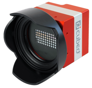
Cubert’s Pioneering Hyperspectral Imaging Solution
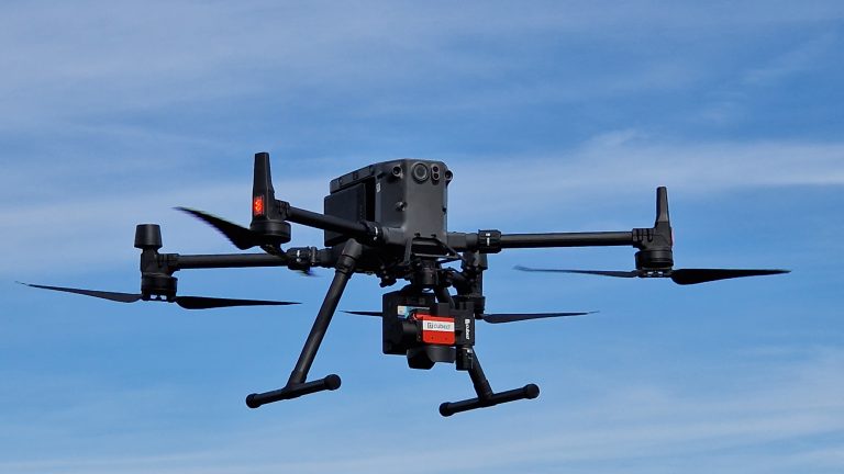
Leading this technological wave, Cubert Hyperspectral presents a user-friendly hyperspectral camera system. This innovative system integrates seamlessly with a gimbal, tailored for the DJI M300 RTK UAV. The system features the ULTRIS X20P hyperspectral camera, which, when paired with the gimbal, ensures stable imagery despite drone movements or tilts. Its seamless connection through the DJI Skyport guarantees straightforward setup and operation.
Included in this system is a mini PC, tasked with collecting image and GPS data from the M300. Equipped with CUVIS software, accessible via the DJI controller, the system simplifies camera operations and settings adjustments. Activation through the drone ensures precise data capture, paving the way for data-driven and informed decisions.
Introducing the UXG Gimbal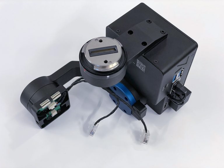
A pivotal addition to the system is the UXG Gimbal, forming a bridge between the ULTRIS X20P and DJI M300 RTK. This component utilizes DJI Skyport for connections and houses an integrated mini computer that controls the camera. It ensures GPS data from the drone is meticulously embedded into each hyperspectral image file, enhancing data richness and utility.
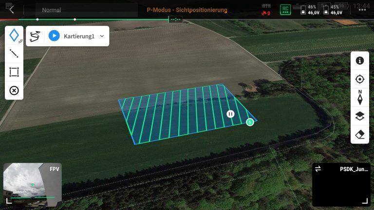
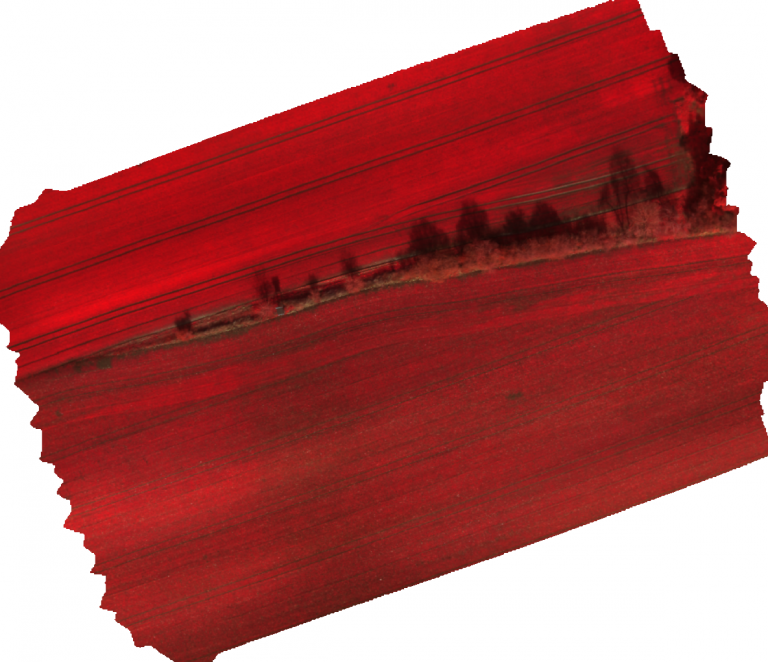
Empirical Validation through a German Feasibility Study
To validate the effectiveness of the X20P camera system in conjunction with the UXG gimbal, a feasibility study was undertaken near Ulm, Germany. Conducted over an early season agricultural field, the study capitalized on ideal weather conditions for aerial flight tests.
Post-flight, the hyperspectral data can be transformed into an orthomosaic. Processing through geoinformation system software, such as AgiSoft Metashape, aligns and stitches the images using GPS coordinates and common pixels. This meticulous process eliminates distortions, resulting in a cohesive orthomosaic. The final product, a hyperspectral orthophoto, combines elevation and position data, serving as a foundation for a diverse array of positionally accurate analytical outputs.
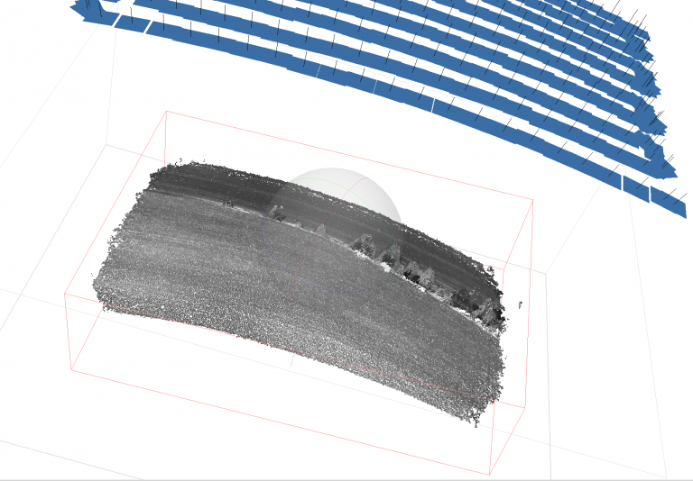
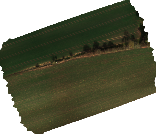
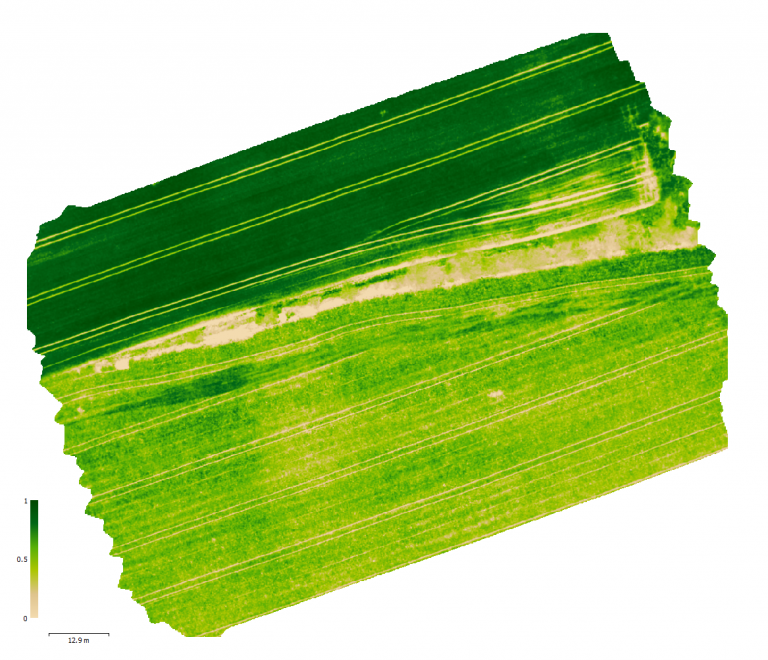
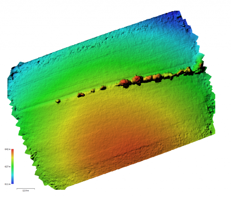
From left to right:
– Point cloud from the common intersection points of the individual images with the corresponding individual images.
– RGB True Color
– Colored Infrared (CIR)
– Digital elavation model (DEM)
– Hyperspectral NDVI
In conclusion, Cubert’s innovative approach to integrating drones with hyperspectral imaging for UAV Hyperspectral Mapping represents a significant leap forward in the agricultural and forestry sectors. The advanced technology, coupled with ease of use and robust data-driven insights, is redefining industry standards in efficiency, productivity, and informed decision-making.
Would you like to learn more about this? Please contact us and we would be more than happy to schedule a meeting with you.
#Hyperspectral #UAV #Mapping #Cubert